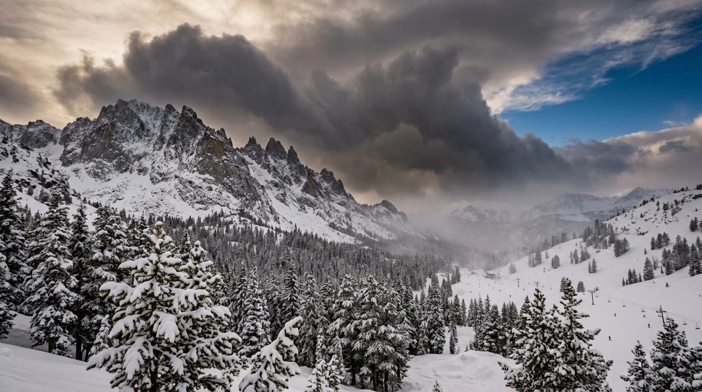
Tahoe snowfall patterns develop mainly when Pacific storms strike the Sierra Nevada. The mountains force moist air upward, where it cools and produces rain or snow. One trip can include deep mountain snow, rain at lower elevations, strong ridge winds, and clear spring weather.
A single snowfall total tells only part of the story. Snow level, elevation, wind, temperature, and storm timing determine what reaches the roads, base areas, and upper mountain.
Tahoe often receives denser snow than colder inland regions. Sierra storms usually carry relatively warm Pacific moisture, which creates heavier snow known as “Sierra Cement.” This snow builds a durable base but can feel demanding under skis and shovel blades.
Conditions also vary around the lake and across elevations. A wet parking lot does not mean rain is falling on upper terrain. Likewise, snow at the base does not guarantee an easy drive over Donner Summit.
What Creates Tahoe Snowfall Patterns?
Most major Tahoe storms begin over the Pacific Ocean and move inland with moisture and wind. When the air reaches California, the Sierra Nevada pushes it upward. Meteorologists call this process orographic lift.
As the air rises, it expands and cools. Cooler air holds less water vapor, so moisture condenses into clouds and falls as rain or snow. The Sierra crest and slopes facing the incoming wind often receive the heaviest precipitation.
This mountain effect can produce substantial snowfall in the high country while leaving eastern valleys comparatively dry. After the air crosses the crest, it descends toward Reno, then warms and dries. This process creates a rain shadow.
Each storm produces a different result. Wind direction, temperature, moisture supply, and the location of precipitation bands can shift the favored area. Those changes often create sharp differences across short distances.
Atmospheric Rivers and Pacific Moisture
An atmospheric river is a long, concentrated corridor of atmospheric water vapor. When one reaches California and points toward the Sierra, it can feed hours or days of mountain precipitation.
Atmospheric rivers do not always produce snow at every elevation. A cold system may bring snow to lower communities. A warmer one may produce rain below and snow higher on the mountain.
The direction of the moisture plume also matters. Mountain slopes receive more precipitation when wind drives moist air directly against them. A small change in storm direction can favor a different drainage or section of the crest.
Not every Tahoe storm qualifies as an atmospheric river. Colder systems with less moisture may produce smaller totals but lighter, drier snow. That snow can feel softer under skis than a much deeper layer of warm storm snow.
Why the Sierra Crest Matters
The Sierra crest blocks incoming weather and removes moisture from Pacific air before it reaches the Great Basin. Palisades Tahoe includes the Olympic Valley and Alpine Meadows sides, which the Base-to-Base Gondola connects. Weather can differ between them during the same storm cycle.
Elevation adds more variation. Air temperatures generally decrease with height. As a result, rain may fall near Lake Tahoe or in Truckee while snow accumulates on upper mountain terrain.
Ridgelines also face stronger winds than sheltered slopes. Gusts can disrupt lift operations, move fresh snow, and reduce visibility above the trees.
A regional forecast provides a starting point, not a complete ski-day plan. The National Weather Service Reno office explains the broader storm pattern. Palisades Tahoe reports daily lift, terrain, gondola, parking, and operating conditions.
Snow Level Is the Key Line in a Tahoe Forecast
Snow level describes the approximate elevation where precipitation changes from mostly rain to mostly snow. It is not a fixed or perfectly level boundary. It may rise or fall quickly as a storm develops.
The rain-snow line on the ground can differ from the forecast snow level. Heavy precipitation sometimes pulls colder air downward and produces snow lower than expected. Meanwhile, warm air aloft can turn snow into rain or mixed precipitation.
For skiers, snow level explains why upper slopes may accumulate snow while a base area stays wet. For drivers, it suggests where pavement may change to slush, packed snow, or ice.
A lower snow level does not guarantee an easier or better storm. Cold snow can create slick roads and poor visibility. A rising snow level can saturate the snowpack, increase runoff, and produce a crust after temperatures fall.
Why Tahoe Snow Is Often Dense and Wet
Tahoe storms often carry air that has crossed the relatively mild Pacific Ocean. Near-freezing temperatures create wetter flakes that may stick together or partially melt during their descent.
This process often produces compact, moisture-rich snow instead of light powder. Skiers call it Sierra Cement because it resists forced turns and punishes a back-seat stance.
Dense snow still has advantages. It forms a supportive base and covers old surface irregularities efficiently. It can also ski smoothly when you stay centered and make patient, rounded turns.
Snowpack layering requires attention outside controlled resort terrain. A warm, heavy layer over colder snow can increase instability. Rain on existing snow may create additional avalanche concerns.
Backcountry travelers should consult the Sierra Avalanche Center before leaving. They also need avalanche training, a capable partner, and rescue equipment that includes a beacon, shovel, and probe.
Why Snowfall Varies Around Tahoe
A storm total from one location cannot represent the entire Tahoe region. Elevation, crest exposure, wind direction, and local terrain all influence how much snow reaches the ground.
Areas near the crest often intercept Pacific moisture first. Locations farther east may receive less precipitation because they sit within a partial rain shadow. However, northerly or southerly winds can shift the main precipitation band.
Local valleys sometimes trap cold air near the surface. Snow may continue there while warmer air moves across surrounding ridges. Mild air can also mix into a valley and push the rain-snow line higher.
Lake Tahoe influences nearby temperatures and cloud formation, but it does not drive the region’s largest storms. Pacific moisture rising over the Sierra remains the main source of major snowfall.
Wind Loading, Scouring, and Uneven Snow Depth
Fresh snow does not always remain where it falls. Strong Sierra winds strip snow from exposed ridges and deposit it in gullies, bowls, and sheltered terrain.
This redistribution creates major differences between nearby slopes. An exposed run may feel scraped and firm while a sheltered pitch holds deep snow. Therefore, a reported storm total cannot describe every run’s depth or surface quality.
Wind may close exposed lifts even when the lower mountain feels calm. After a storm, operations teams may need time for avalanche mitigation, grooming, digging, and lift preparation.
Never cross a closure or duck a rope to reach untouched snow. Closed terrain may contain avalanche hazards, machinery, unfinished patrol work, or concealed obstacles.
How Tahoe Snow Changes Through the Season
Early-season storms often fall on thin, uneven coverage. Rocks, logs, and brush may remain close to the surface. One large storm can make the mountain look covered without creating a supportive base everywhere.
Successive winter storms usually deepen and refresh the snowpack. Surface quality still depends on temperature, sun, and wind. Sheltered cold snow behaves differently from wind-pressed or sun-affected snow.
Warm storms may bring rain, dense snow, or rapid changes in snow level. A cold front can then cover the wet surface with lighter snow. This sequence produces distinct layers within the snowpack.
Later in the season, stronger sunlight and overnight temperatures have a greater effect. North-facing slopes tend to preserve winter snow longer. Sunny aspects change faster throughout the day.
Freeze-Thaw Cycles and Spring Corn Snow
Spring corn develops through repeated melting and freezing. The surface softens during the day, then freezes firmly overnight. Sunlight and warmer air loosen the top layer again the next morning.
At the right stage, the snow becomes smooth and granular over a supportive base. Skiers call it corn because the loose grains resemble small kernels.
Timing often matters more than new snowfall on spring days. Start too early, and the surface may remain icy. Arrive too late, and the snow may become deep, sticky, and tiring.
Aspect controls when each slope softens. Sunny terrain changes before shaded slopes. A cloudy or warm night may prevent a strong refreeze, especially outside controlled terrain.
How to Read a Tahoe Snow Forecast
Start with the National Weather Service Reno forecast instead of relying on a weather-app icon. Its forecast discussions explain timing, snow levels, wind, confidence, and possible changes.
Next, compare the forecast elevations with your route, lodging, and ski plans. A prediction of mountain snow does not describe every access road or base area.
Watch the timing of warm and cold storm phases. Early snow may change to rain when warmer air arrives at lower elevations. Rain may switch back to snow after a cold front passes.
Keep weather forecasts separate from resort operations. Forecasts describe what may fall from the sky. Palisades Tahoe confirms lift status, terrain openings, gondola operations, and parking requirements.
Use Each Weather and Travel Source for Its Specific Role
| Source | What to check | Why it matters |
|---|---|---|
| National Weather Service Reno | Storm timing, snow level, wind, warnings, and forecast discussions | Explains the regional weather pattern and forecast uncertainty |
| UC Berkeley Central Sierra Snow Lab | Measured snowfall and snowpack data from its research site | Provides observed Sierra data rather than broad app estimates |
| Sierra Avalanche Center | Backcountry avalanche forecasts and snowpack concerns | Helps trained backcountry travelers assess avalanche danger |
| Palisades Tahoe | Lift, terrain, parking, gondola, and mountain updates | Confirms current resort operations |
| Caltrans QuickMap and road information | Chain controls, closures, incidents, and highway conditions | Shows how weather affects California state highways |
These sources serve different purposes. Snow measured at the Central Sierra Snow Lab does not equal snowfall at the resort, your lodging, or the highway.
The Sierra Avalanche Center focuses on backcountry decisions rather than resort operations. Ski patrol manages in-bounds terrain, but every skier and rider must obey closures and patrol instructions.
Check official sources several times as the trip approaches. Storm timing and snow levels can shift quickly. During active weather, use current road and resort reports instead of old photos or updates from another part of the lake.
What Storm Patterns Mean for Tahoe Roads
I-80 over Donner Summit and sections of Highway 89 can close during severe storms. Such closures may leave few practical routes to Olympic Valley. Treat heavy mountain precipitation as a transportation concern, not simply a powder forecast.
Check Caltrans QuickMap or Caltrans road information before driving. Carry water, food, warm layers, a blanket, a shovel, and a phone charger. Keep the fuel tank at least half full.
Under California R1 controls, passenger vehicles and light-duty trucks may proceed without chains if they have qualifying snow-tread tires on the drive wheels. Other vehicles must use chains as directed. Every vehicle must carry the correct chains.
Under R2 controls, vehicles generally must use chains. Four-wheel-drive and all-wheel-drive vehicles may proceed without installing them if qualifying snow-tread tires cover all four wheels. Those vehicles must still carry chains.
Under R3 controls, every vehicle must install chains without exception. Caltrans may close a road before using R3 controls because conditions are often severe. Always follow current signs and official instructions.
Practice installing chains at home and confirm that they fit your vehicle. If you drive a rental car, review the rental agreement before using chains.
If traffic stops during heavy snow, keep the exhaust pipe clear. A blocked tailpipe can force carbon monoxide into an idling vehicle. Check it regularly and avoid running the engine continuously.
How Snow Patterns Affect a Ski Day
After a storm, expect changing surfaces from top to bottom. Upper terrain may hold colder snow, while lower slopes may feel heavier. Exposed ridges may have firm, wind-scoured patches.
Dense powder rewards a centered stance and patient turns. Leaning far back tires the legs and makes the skis harder to steer.
Visibility may present the greatest challenge while snow continues to fall. Trees and other fixed objects provide contrast. Stay on open in-bounds terrain and give tree wells plenty of space.
Deep-snow immersion and tree-well suffocation can be fatal. Ski with a partner and keep each other in sight. Tracks beside a tree do not prove that the area is safe.
Follow the National Ski Areas Association’s Your Responsibility Code. Stay in control, yield to people downhill, and stop only where others can see you. Look uphill before starting or merging.
Prevent runaway equipment and obey every sign and closure. Learn how to load, ride, and unload each lift before using it.
Wear a properly fitted snow-sports helmet that meets a recognized safety standard. Replace it after a major impact. At altitude, use sunscreen, lip balm, goggles or sunglasses, and drink water throughout the day.
A Practical Routine for Tracking the Next Tahoe Storm
Begin with the National Weather Service Reno forecast discussion. Identify the expected timing, snow level, wind, and major uncertainties. Then compare those details with your route and destination elevations.
Check Caltrans for controls, incidents, and closures before leaving. Confirm parking, lift, terrain, and gondola information with Palisades Tahoe. Leave flexibility in your schedule when a storm may affect arrival or departure.
Use the Central Sierra Snow Lab for measured regional snowfall data. Consult the Sierra Avalanche Center before any backcountry travel. Neither source can guarantee a specific surface at every elevation or on every run.
Understanding Tahoe snowfall patterns makes forecasts more useful. Focus on where the snow will fall, how much moisture it will contain, and where the wind will move it. Road access and mountain operations matter just as much as the final storm total.